
Pittsburgh in 50 Maps by Stentor Danielson
Written by Curtis Miner in the Book Review category and the Summer 2026 issue Topics in this article: geography, maps, Pittsburgh, Stentor Danielson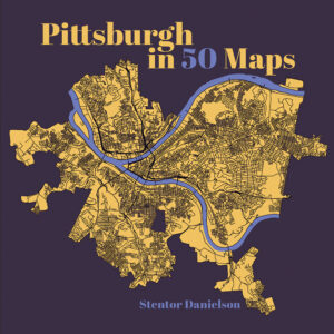 Pittsburgh in 50 Maps
by Stentor Danielson
Belt Publishing, 136 pp., hardcover $30
If a picture says a thousand words, what might we say about a map, or more to the point, 50 maps, professing to explore and reveal the patterns and contours of a single city? Based on the specimens gathered together in this highly informative, often surprising, and relentlessly original volume by Stentor Danielson, the answer is quite a lot, and then some.
Danielson, an associate professor of geography at Slippery Rock and self-described “map nerd,” has arranged his collection into four sections: Situating the City, Getting Around, Communities and Neighborhoods, and Places and People. Each single-topic, easily comprehended map is accompanied by a page of engagingly written, refreshingly jargon-free text that provides just enough description and insight to pique readers’ interest without overwhelming with detail.
The subject matter contained in this slim but substantive volume is alternately whimsical and deadly serious — quite literally, in the case of a map documenting the location of old houses and lead paint. Others in this vein include maps on gentrification, tree cover, supermarkets and food deserts, and air quality. (Long after the sulphureous smoke left, asthma levels remained high.) But this is leavened with maps illuminating known and lesser-known Steel City peculiarities: the “Pittsburgh Left,” identifying intersections where motorists are likely to encounter the infamous quirk of Pittsburgh driving culture; Mister Rogers’ Neighborhood, locating not only where the long-running children’s program was filmed, but also the places around the city where its namesake host lived, studied and worshipped in real life; and a map dissecting the location of a single ill-placed parking spot that has unnerved residents of the city’s East End for 50 years. Other maps plot the location of the city’s fabled (if inconsistently counted) bridges, its now-crumbling concrete stairways, and both its historic and contemporary funiculars — all pieces of the built environment adapted to the city’s peculiar geography.
Which is to say: what unites all of these maps is their open-minded curiosity about Pittsburgh, that famously enigmatic settlement set up on a lumpy, wedge-shaped landmass formed by the conjoining of two rivers at the Point. An alternate title could easily have been “Mapping the Mysteries of Pittsburgh,” a place known historically and to this day for its physiographic nooks and crannies and what Roy Blount Jr. called the “stout localism” of its residents. If there’s one criticism, it’s that the volume’s compact 8-by-8-inch format constricts a fuller explication of those mysteries. These maps want space to breathe and further reveal their secrets. And it has left open, at least for this reviewer, a desire for a second urban explorer’s guide to this most remarkable and still underappreciated metropolis.
Curtis Miner
The State Museum of Pennsylvania